Visitors Experiences
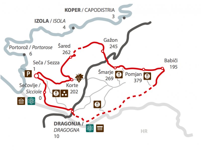
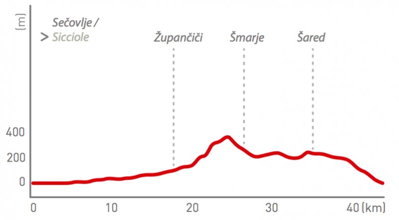
Interactive map: Po dolini reke Dragonje (K6)
Time: 2h30 – 3h Path lenght: 44 km Altitude: 2 m – 386 m
Parking: Seča, near the entrance of the Sečovlje Salt Pans.