Route Map

Altimetry


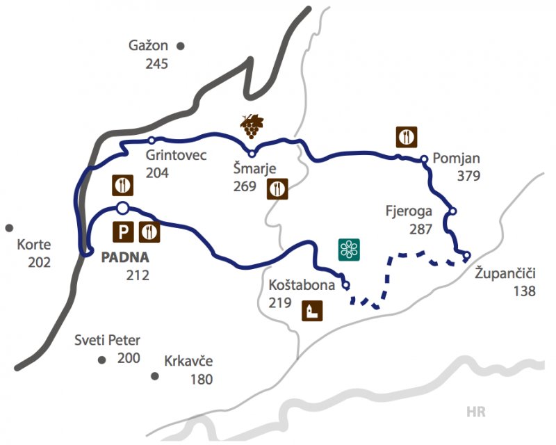
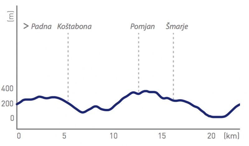
Interactive Map: Čez drn in strn (K11)
Time: 1h30 – 2h
Path Lenght: 23 km
Altitude: 34 m – 386 m
Parking: Padna, parking in front of the tavern Istranova.

Attempting to load Google Maps API.. Please wait.
This functionality requires cookies to be enabled, it will not work otherwise


