Route Map

Altimetry


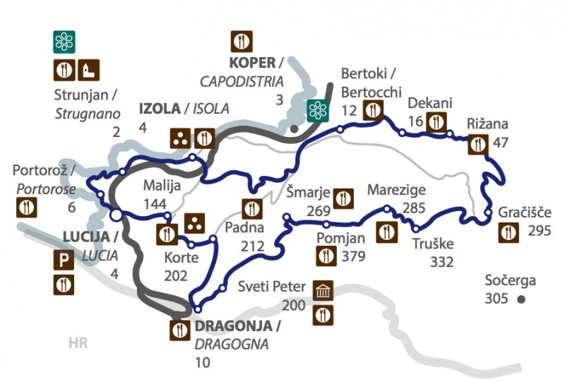
Interactive Map: Čez Istro za zahtevne (K13)
Time: 4h – 5h
Path Lenght: 83 km
Altitude: 2 m – 403 m
Parking: Lucia, parking in front of the marina.

Attempting to load Google Maps API.. Please wait.
This functionality requires cookies to be enabled, it will not work otherwise


