Route map

Altimetry


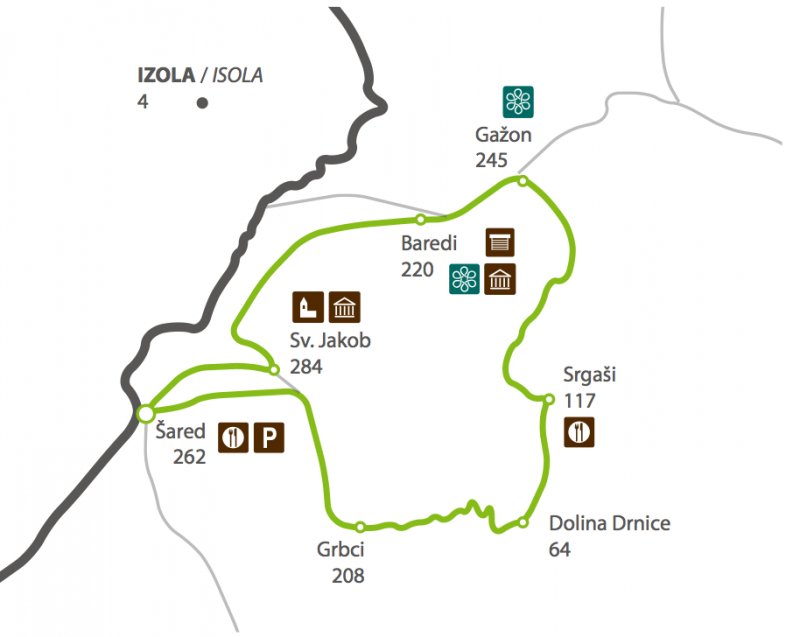
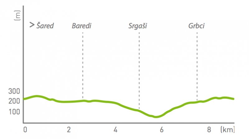
Interactive route map: Pot po soncu (P12)
Time: 2h30 – 3h30
Path length: 9 km
Elevation: 64 m – 271 m
Suitable for: Families.
Parking: Parking by the bar Šaredin (Šared).

Attempting to load Google Maps API.. Please wait.
This functionality requires cookies to be enabled, it will not work otherwise


