Path map
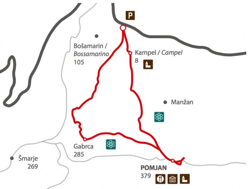
- The track starts at the parking place, passes by the chapel which is on our left side, continues along the valley for 200 metres, turning right over the bridge where the road rises above the gorge, continuing straight ahead.
- At the signpost and the bench of the Lovrečič mountain trail, we turn right into the forest and gradually climb the slope towards the border of a large olive grove. From here, we follow the trail markers which leads us left down to the gorge with the modest spring.
- Here we cross the gorge and start to climb on the path which rises in numerous turns till the straight cartroad which cuts the slope of Poljane.
- We cross it and continue along, at times, quite steep track. During the wet periods, the whole ascent from the gorge can be slippery due to the mud, therefore be careful.
- The path continues towards left through the forest along the cartroad which rises for a short time and that straightens again to bring us on the road which rises from Manžan towards Pomjan.
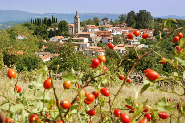
- Along the marvellous views, the path riches the highest village of the hills Šavrinski gričevje, at the church of St. Mary’s Birth with Glagolitic inscriptions, Pomjan.
- We continue towards the grait panoramic spot along the main road between the houses up through the village, passing by the church and the tavern on the right where we can stop and refresh. Below us opens a marvellous view towards the hills of Šavrinsko gričevje and the valley of Vanganel, the Gulf of Koper on the left, Slavnik and the peaks of Čičarija. On sunny days, we can admire the peaks of the Alps and Dolomites.
- It is time to return. We return by crossing the village along the same track we used for the ascent. We turn left following the trail markers and descend along the cartroad which passes by the water reservoir, arriving at the sharp turning. Immediately after the turning we turn on the left hiking trail which sweeps steeply through the forest till the cleft on a large slab.
- Planinska pot gre levo, mi pa nadaljujemo naravnost navzdol do ceste, ki se konča pri hiši v zaselku, ki mu pravimo Kampel Brda.
- The hiking trail continues towards left, however, we continue straight ahead till the road which ends at the first house of the village called Kampel Brda. We leave the road which passes by the house and take the path which splits and sweeps gently along the right slope of the gorge till reaching the road.
- There we turn left and, in an arch in the right direction, reach the asphalt after a gentle climb. We sweep along the road towards the crossroad, continue passing by the built-up area of family houses and reach the valley after a double turning and a steep descend.
- When the road strengthens, we are only 300 metres away from the chapel where we started our circular track.
Path altimetry

