Path map
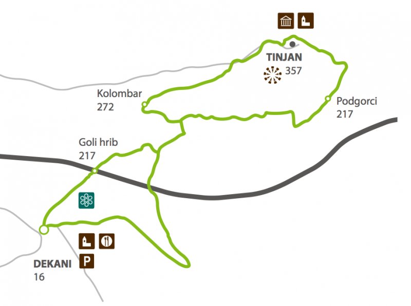
- The track starts in the centre of the village, at the parking place, in front of the church. From there we go towards the cooperative home, than left up the right turning and pass the cooperative home.
- After 100 metres we turn left (the blue signpost Galerija) and slightly up, pass the last houses and arrive among the wide olive groves and vineyards.
- At the crossroads at the edge of the forest, we turn right towards southeast to the panoramic spot and a resting place above the village Miši.
- From there, the road turns left and starts to climb the slope through the pine forest situated along the right side of the crest Goli vrh. In the last part, a marvellous view opens towards Dekani below us and Koper in the distance.
- We arrive at the following panoramic spot, from where a view opens towards east, the valley of river Rižana and the Karst border with Slavnik and Kojnik in the distance.
- The path slightly sweeps and transforms in a forest road, along which we continue our walk by turning right and up towards the crossroads below Kolombar, where stands the information board of the Dekani circular path.
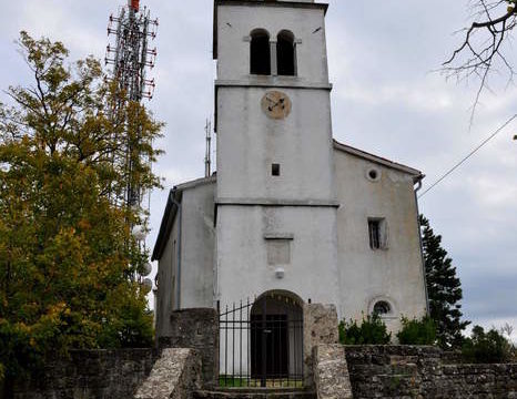
- High above us we can see out next stop, the peak of Tinjan with the church of St. Michael and the high tower of antennas.
- The path continues along the asphalt and, at the first house, turns left towards the end of the village, where, at the large rock and the electric pole, the signpost “Tinjan” directs us on the right, up the stone stairs and towards the stone path which rises in the direction of the forest.
- The path straightens and leads us, in a gradual climb, towards northeast on the asphalt in front of the signpost Tinjan, where we turn right, around the chapel, pass the puddle and arrive to the church of St. Michael with a mighty linden tree in the centre of the village. We have reached the highest point and are rewarded with a view in all directions.
- From here, we descend between a nicely renovated stone house and a water reservoir to the great panoramic spot at the northern side of the peak of Tinjan. The view opens towards the valley of Osp and the famous walls which attract climbers from all over the world.
- From here we sweep steeply straight ahead between the water reservoir and the puddle, where we turn on the right cartroad which later becomes a concrete road at the village Podgorci.
- A bit lower, a wide road splits on the right and lead us, almost horizontally along the southern slope of Tinjan, back to Kolombar. We descend along the same path we used for the ascent, until the sign “slap” (cascade) directs towards right on a road which leads down in the gorge.
- We take the left path at the crossroads towards the wooden bridge which crosses the stream above the cascade. Our path comes out of the forest at the edge of a wide olive grove and leads us down to the houses of Dekani and the parking place where our journey ends.
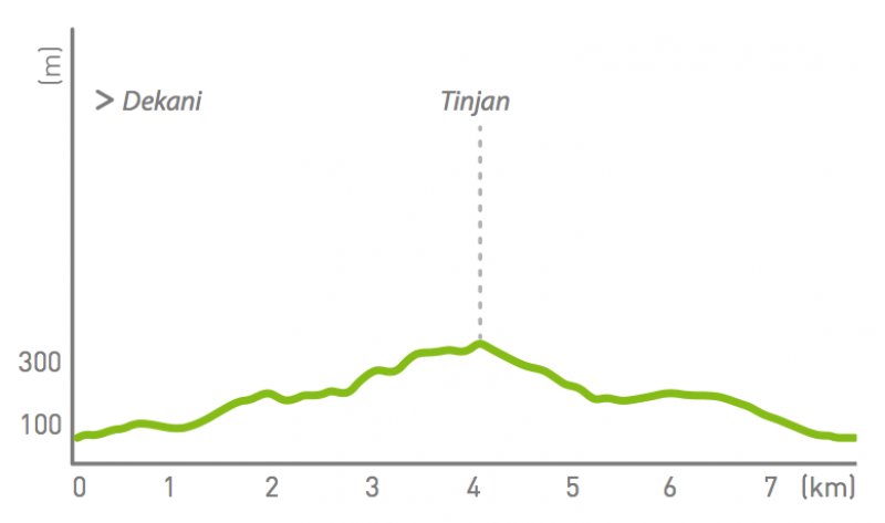
Path altimetry