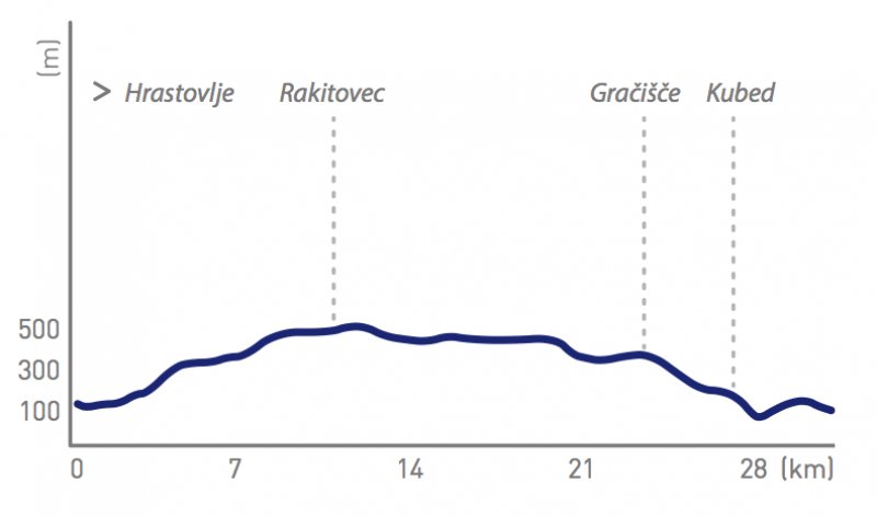
Path map
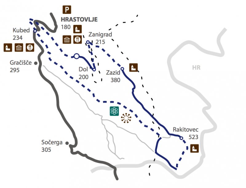
- We start at the parking place in front of Gostilna (tavern) Švab, from where we drive to the chapel in the middle of the crossroads and climb the gentle slope which brings us to the village Dol.
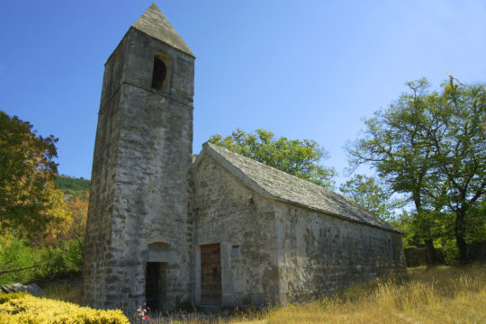
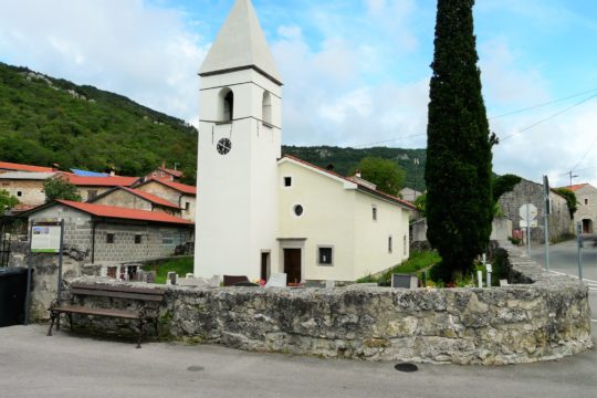
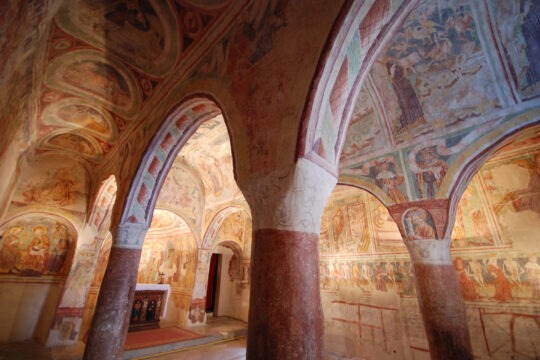
- There is a signpost “Zazid” on the wall of the church which directs us around the fire station to the macadam road which sweeps gently and then starts to gradually climb towards Zanigrad. The last part of the climb is very steer and due to the gravel, hard to drive on. There we can visit the ancient church of St. Stephen with frescoes, and than continue through the abandoned village towards the underpass below the railway. There, the road transforms in a damaged cartroad which starts to ascent along the left side of the valley. The technical ascent (around 600 metres) is very hard due to the bas ground. Less prepared cyclists can walk over it and continue when the road straightens and continues towards the interesting village Zazid, located underneath the walls of the Karst border (water).
- Before reaching Zazid, we take the right macadam road at the crossroads and pass the wastewater treatment plant.
- The road continues along the asphalt in a gentle ascent towards the renovated puddle and from there quite steeply up on the large back, where it straightens again.
- There we cross the railway Diveče – Pula and reach the crossroads with the information board and a resting place in front of the village Rakitovec.
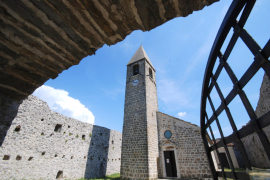
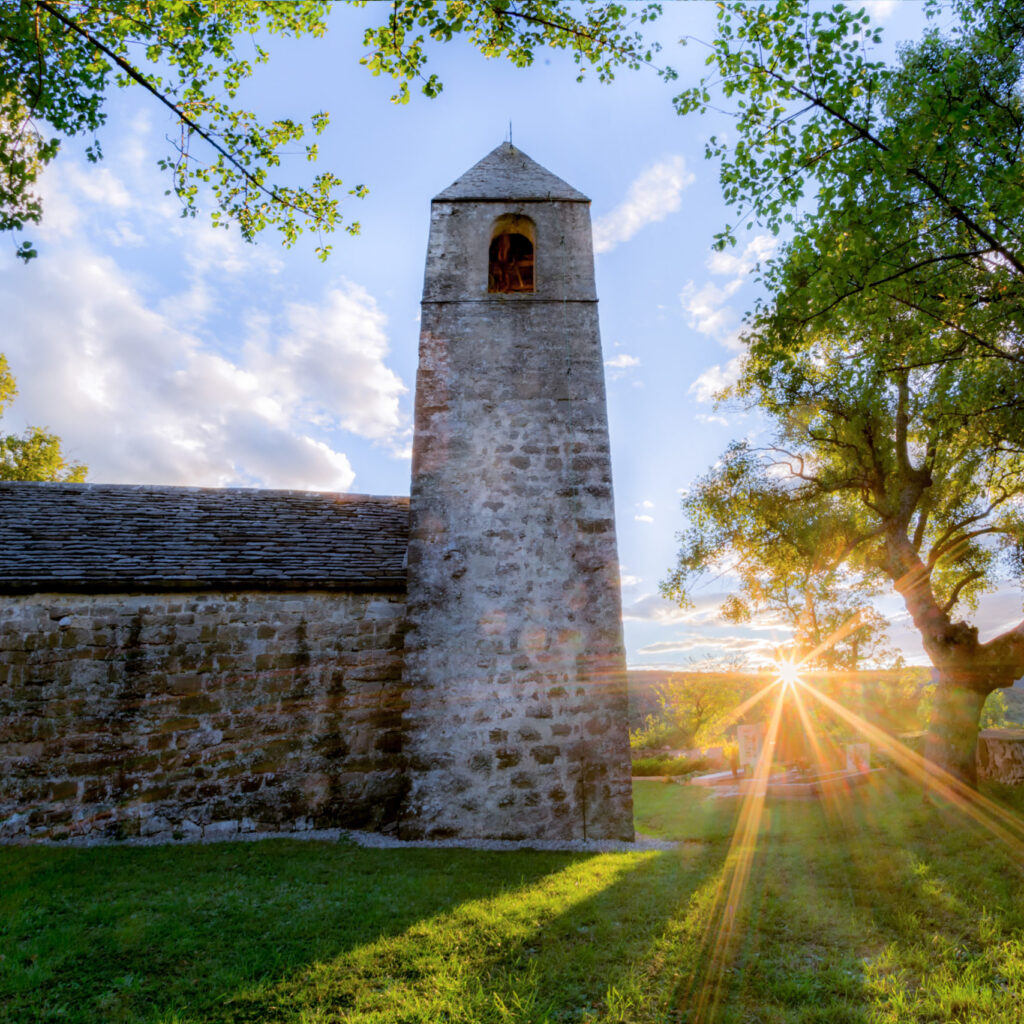
- We turn left and go down to the village and reach the renovated puddle and the church of St. Cross with the interesting bell tower. From there, we continue through the village towards southeast till the end of the asphalt.
- We continue along the macadam until we reach the forest road which splits on the right (there is a sign: “forest road – use at your own responsability”) that brings us to the ridge with an interesting sign from 1867.
- The path that runs parallel with the border starts to sweep becoming almost narrow after few turns and brings us to the asphalt, about 300 metres before the border.
- There we turn right and soon reach the road (on the left side) from Movraž and crosses the railway. However, we continue straight ahead parallel to it till the railway, where is possible to refill with water.
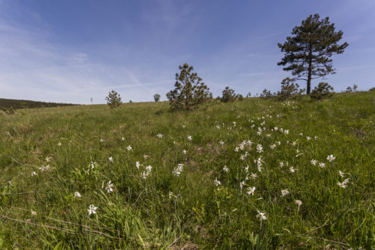
- After about 150 metres, at the crossroads with the information board, we leave the asphalt and turn left on the forest road that after 200 metres crosses the railway and leads us almost horizontally along the ridge with magnificent panoramic spots to Kuk above Movraž. The path runs through wide pastures. We need to cross the fence twice, extra watchful to the wire. In the meantime, trail markers of the “Path of the castles” join us from the left and accompany us till Kubed.
- The path then starts to sweep for some time and after that again straightens. The soil becomes rougher. We are driving on the top of the crest for the whole time. The soil slightly waves till reaching a steeper ascent on the top of Lačna.
- We reach the crossroad where the rocky edge starts to steeply sweep left towards Smokvica.
- There we can reach the asphalt which brings us to Kubed. A more adrenalin ride follows. Those who are not fond of such rides, can cut the path to Smokvica and then, along the asphalt pass Gračišče and Kubed, where can join again on the original path which continues straight ahead.
- Higher, where the signed path turns right, we take the left turn and continue for about 220 metres, and than along a hardly visible path which splits at 90 degrees right (signpost “stolp”- tower), reach the top of the mount Lačna with the panoramic tower.
- We return back to the main road which starts to gradually sweep and is, at moments, very rough. Lower, at the crossroads (after about 1.7 km) we turn left where the road turns into a path which sweeps over the rocky edge to the stream and the road for Kubed.
- For those with less experience is recommendable to do the descent on foot.
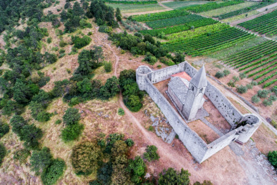
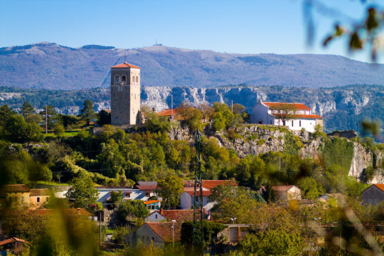
- We cross the road and follow the sign markers up to the church of St. Florian and the famous pentagonal bell tower.
- From there we continue along the ridge in the northwest direction, turn right at the mirror and after 150 metres carefully (!) sweep down to the cartroad, pass by the wastewater treatment plan and rich the main road (Kubed – Hrastovlje).
- From there we continue down towards the valley and then back up to Hrastovlje.
- When we arrive at the vineyards, the road straightens and sweeps down to the starting point.
Path altimetry