Path map
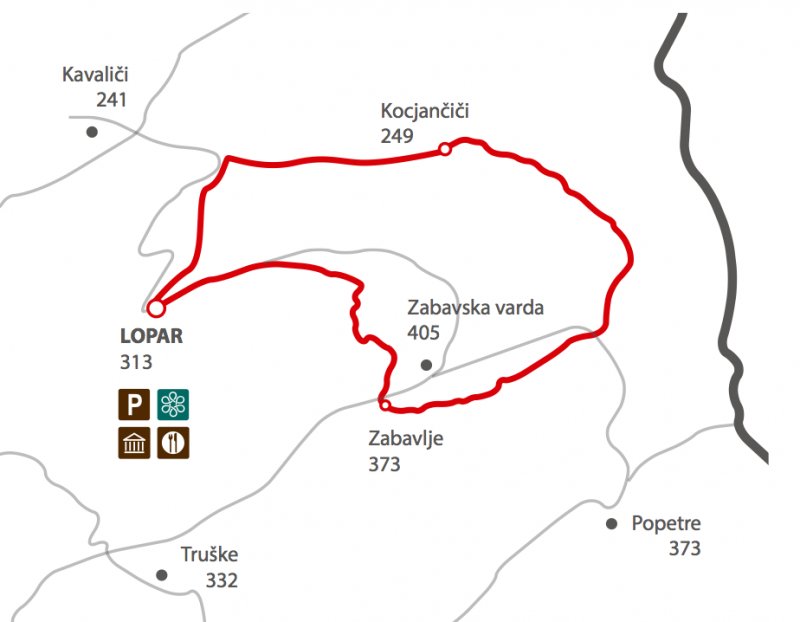
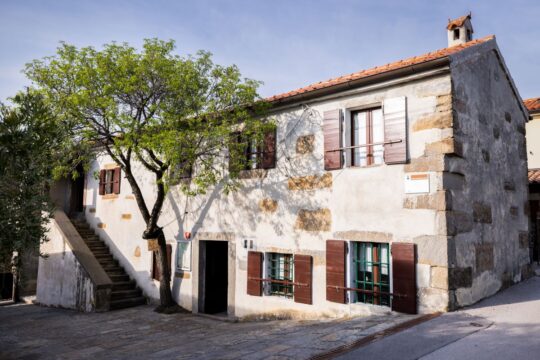
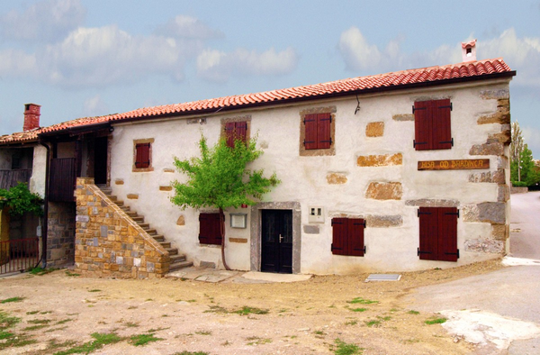
- Our path starts at the parking place in front of the Brandinec house, home of the local ethnological collection worth visiting. From here, we start our climb by turning right through the village, passing by the cultural centre and the church of St. Rufus with the three mighty oaks.
- We continue towards the puddle, where we turn right and join the cartroad, than we turn left and walk along the supporting wall near the vineyard towards the forest, where the path becomes steeper.
- From there, we go down towards the stream Saje, cross the path at the right side and direct up in a sort of chute, which in periods of heavy rain becomes a brook with numerous bends, climbing up the forest.
- In case of heavy rain, it can be impossible to cross the brook.
- The path later becomes a wide cartroad which gradually rises in the south direction till reaching the asphalt road at the top of the ridge.
- We cross the asphalt road and continue to the first houses of the village Zabavlje.
- Here, we turn left, again on the asphalt, and after 100 metres turn right in the forest along the concrete supporting wall. At the crossroads, we continue left and down, than make a sharp turn on left and up towards the ditch.
- We continue along the road on the left; the road straightens almost completely, than turns left and up towards the asphalt road below Varda. From here a view opens towards north and east, we can see Tinjan and the Kars border over the valley of Rižana.
- Here, we cross the road and take the cartroad on the left, which starts to sweep towards the valley of Rokava under the village Kocjančiči.
- Towards the end, the path is steeper and damaged by the water. At the confluence of the ditches, the path straightens and becomes macadam.
- From here, it starts to climb again and after 100 metres from the lowest point, a narrow cartroad splits left and takes us to the stream Rokava. After crossing the stream, the cartroad becomes a path which winds along the left side of the stream, going up and down, never leaving the forest.
- When we cross the stream again, the valley straightens becoming wider.
- Continuing along the straight cartroad, we reach the asphalt road where we turn left and continue towards the bridge over Rokava. From here, the road goes up for another 120 metres till the concrete road which splits on left and continues steeply up the slope.
- The track ends by a nice field house which we pass at the left side and than, immediately behind it turn right on the cartroad which goes up steeply towards Lopar in front of us.
- Higher, we join the cartroad coming from the right side and continue straight ahead towards south and up till the first houses and the asphalt in the centre of the village.
- Here we turn right and go down, passing by the village home and the agritourism Dobrinja on right until reaching our starting point in front of the Bardinc house.
Path altimetry